Support
Upload a dataset
Datasets in LUIMS are published resources representing either raster or vector spatial data. They are a key part of the platform, allowing users to manage spatial data, as well as associated metadata.
See Working with Datasets documentation for more detail.
1
Upload a dataset
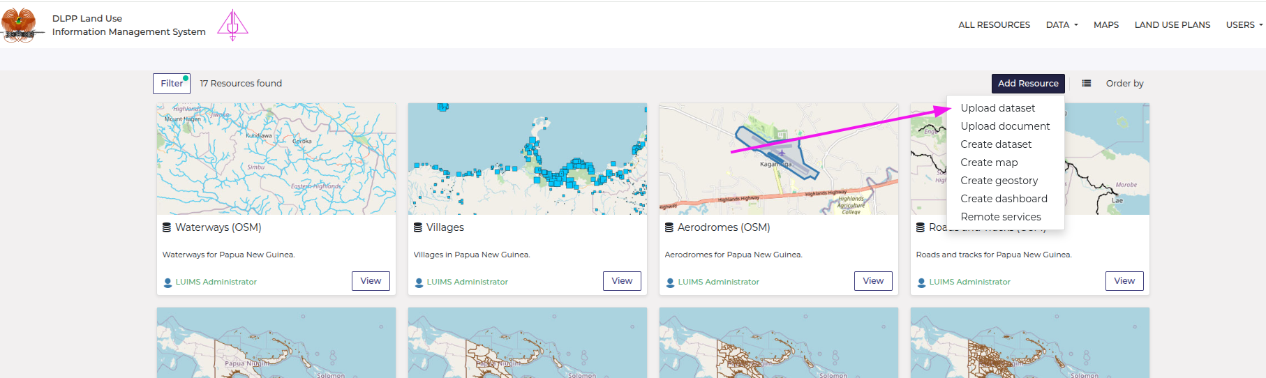
- Click "Upload dataset"
Find the Upload Dataset option in the Add Resource dropdown on any catalogue page, or from the menu on a dataset page.
2
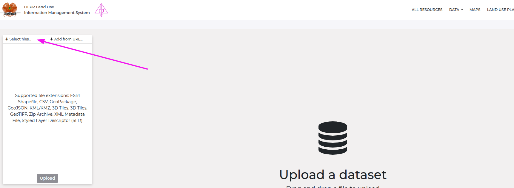
Select files
Click the “+ Select Files…” to browse for your dataset, or simply drag and drop a dataset into the browser window.
3
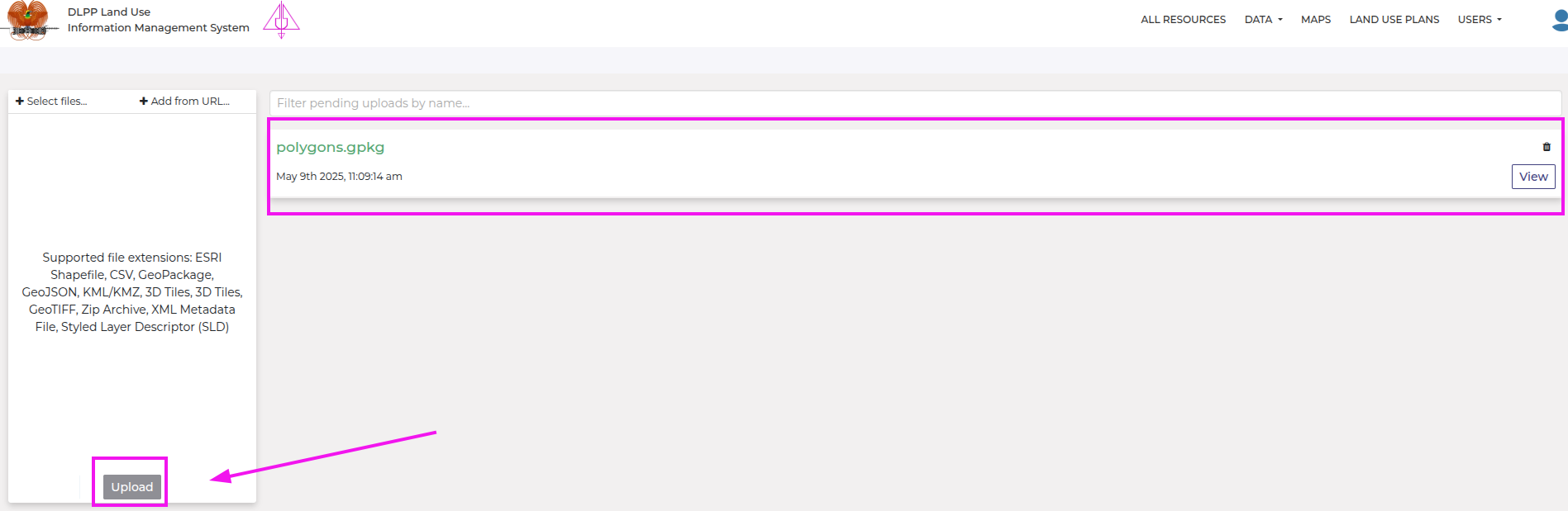
Upload files
Click the Upload button. A pending upload box will appear to show the progress of your file upload.
4
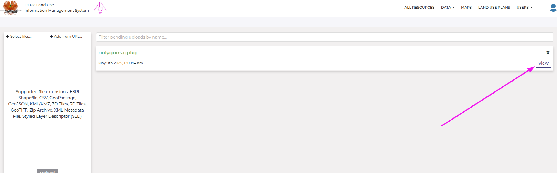
View your dataset
Once the upload is complete, click View to open your newly uploaded dataset.